
Walk an Evansville Street Directory
An address search should build a chain, not jump from one name to a claim about who lives there. Vanderburgh County's assessor identifies a parcel and its listed owner. Evansville GIS places that parcel beside the next lots. The Recorder then connects owners through recorded instruments, while city permits and dated directory volumes add use and occupant clues. Each source answers a different question.
- Enter at least three characters from the street or address in the Vanderburgh XSoft property search. Save the property number, situs address, owner, and legal description.
- Open the parcel in Evansville GIS. Click or query the lots on both sides so each adjacent address stays tied to its own parcel ID.
- Compare the Treasurer roll by property address, parcel, name, and tax year. Keep its tax data separate from proof of title.
- Use the current owner and legal description in the Recorder's grantor/grantee index. Follow each recorded transfer backward.
- Check permits and year-specific street sections in local directories. Use voter information only through the access process Indiana allows.
This street-by-street method can establish ownership, recorded transfers, parcel boundaries, and dated occupant evidence. It cannot prove that every named owner lives on the parcel today.
Evansville Street Search Fields
The Vanderburgh XSoft advanced search can narrow Evansville property results well beyond a street name. Basic search accepts an owner, address, or property number. Advanced controls can isolate a district, neighborhood code, sale range, building type, or physical trait. Those filters help test whether two similar addresses refer to the same kind of parcel.
| Field | Input | Useful street-directory role |
|---|---|---|
| Owner, address, property number | Text, three-character minimum | Starts the parcel search |
| Sale price and date | Numeric and date ranges | Narrows possible transfers |
| Neighborhood and district | Live coded lists | Separates same-named areas |
| Year built and living area | Numeric ranges | Tests a building match |
| Class, style, and plan | Dropdowns | Distinguishes parcel uses |
The portal does not expose a street-wide export control. Search a street string, page through the data-only results, and record each property ID before moving to the map.
The advanced property screen shows the filters used to build an Evansville street directory search.
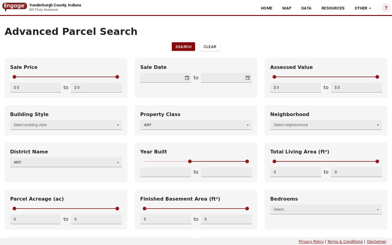
Its district, neighborhood, value, date, and building controls help reduce broad address results without turning the assessment roll into an occupant list.
Read Evansville Parcel Details
A parcel detail is the strongest bridge between an everyday address and the legal identity of land. XSoft may show the parcel number, property address, legal description, owner line, transfer material, valuation history, land and improvements, taxing district, neighborhood, utilities, street features, sketch headings, and photos. The owner mailing line and situs address are separate concepts.
The captured Evansville parcel example demonstrates that richer record layout.
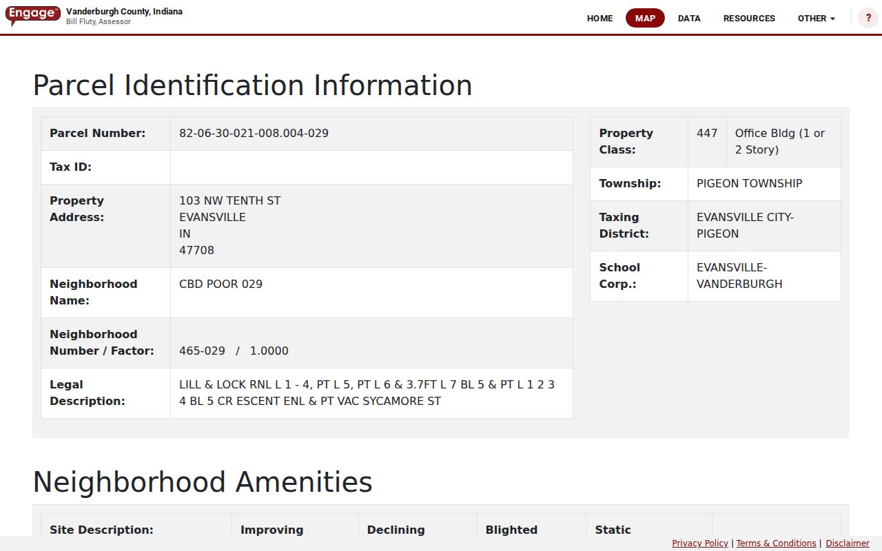
The sample also shows why a property card must be read with care: valuation and improvement history can extend back decades, but the portal does not promise a complete title chain or current occupancy.
- Parcel
- A mapped unit of land identified by a county number.
- Situs address
- The physical property address, which may differ from the owner's mailing address.
- Plat
- A recorded map that lays out lots, blocks, streets, or subdivisions.
- Criss-cross directory
- An address-ordered directory used to move from a street number to a listed occupant.
Evansville Records Indexed by Address
No single Evansville street directory contains all address facts. The assessor and GIS establish parcels, the Treasurer adds a tax-year view, and recorded deeds preserve ownership events. Permit files and historical directories add dates and uses that property rolls may omit.
| Record Set | Keeper | What It Shows | Access |
|---|---|---|---|
| Assessment roll | Vanderburgh Assessor | Owner, situs, legal description, value, improvements | Free XSoft portal; office or phone |
| Parcel map | Evansville GIS | Boundaries, parcel IDs, adjacent lots, map layers | Free map and REST query |
| Tax roll | Vanderburgh Treasurer | District, parcel, name, address, tax year | Online; Civic Center office |
| Recorded instruments | Vanderburgh Recorder | Deeds, mortgages, liens, plats, parties | Free office terminal; Tapestry fee; Laredo subscription |
| Permit record | Evansville Building Commission | Scope, cost, inspections, related documents | MUNIS or focused office request |
| Historic directory | EVPL and Willard Library | Dated occupants, businesses, occupations, old numbers | Digital archive and in-person collections |
When online coverage stops, call the custodian, visit the Civic Center, or send a focused Indiana Access to Public Records Act request. Older deeds, directories, maps, and microfilm may require EVPL, Willard Library, or the Indiana State Library.
Map Evansville Streets by Parcel
The official Evansville GIS parcel service supports query and identify operations and returns parcel geometry. Select the first known lot, then click or query neighboring polygons in order. Record each parcel ID rather than assuming every building entrance shares the same lot.
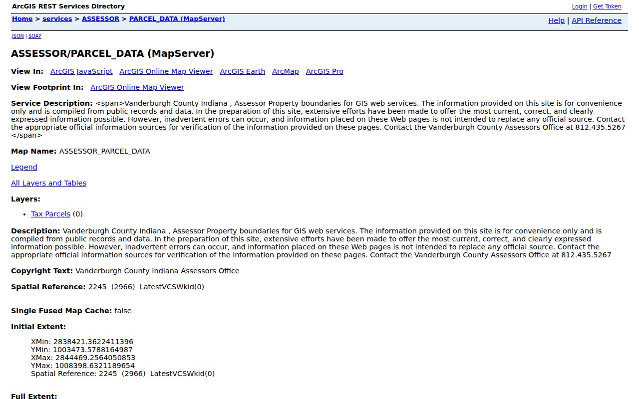
The mapped boundaries turn a street name into a reproducible row of parcels. Neighborhood, assessment, ward, school, ZIP, and association layers describe different geographies and should not be merged.
GIS supplies boundaries, not a household roster. Pair each mapped ID with XSoft detail and, when needed, the Recorder's legal description.
Evansville Deeds Along a Street
The Vanderburgh Recorder holds deeds, mortgages, releases, liens, plats, surveys, contracts, and other instruments. Begin with the current owner and legal description from XSoft. Search that owner as grantee to locate the acquisition, read the instrument, then search the grantor as a prior grantee. Lot, block, subdivision, parcel, and map-and-bounds fields can bridge a spelling or address change.
Recorder access instructions document three channels: free public computers in Room 231, fee-based Tapestry for occasional remote searches, and subscription Laredo. The office does not conduct title searches. The exact online date cutoff was not published, so older work can move to the Recorder, the State Library microfilm guide, or a focused records request.
State Library microfilm preserves Vanderburgh grantor and grantee indexes from 1818 through 1901. That long run is the street directory fallback when a vendor screen cannot reach the needed era.
Evansville Permits by Address
Building and inspection records add a dated event to an address. The city workflow may include the work address, scope, cost, applicant or license-holder contact, plans, an application reference, inspection events, related documents, and a certificate where available. The exact historical cutoff was not documented.
The Evansville MUNIS permit portal is the online starting point for permits and inspections.
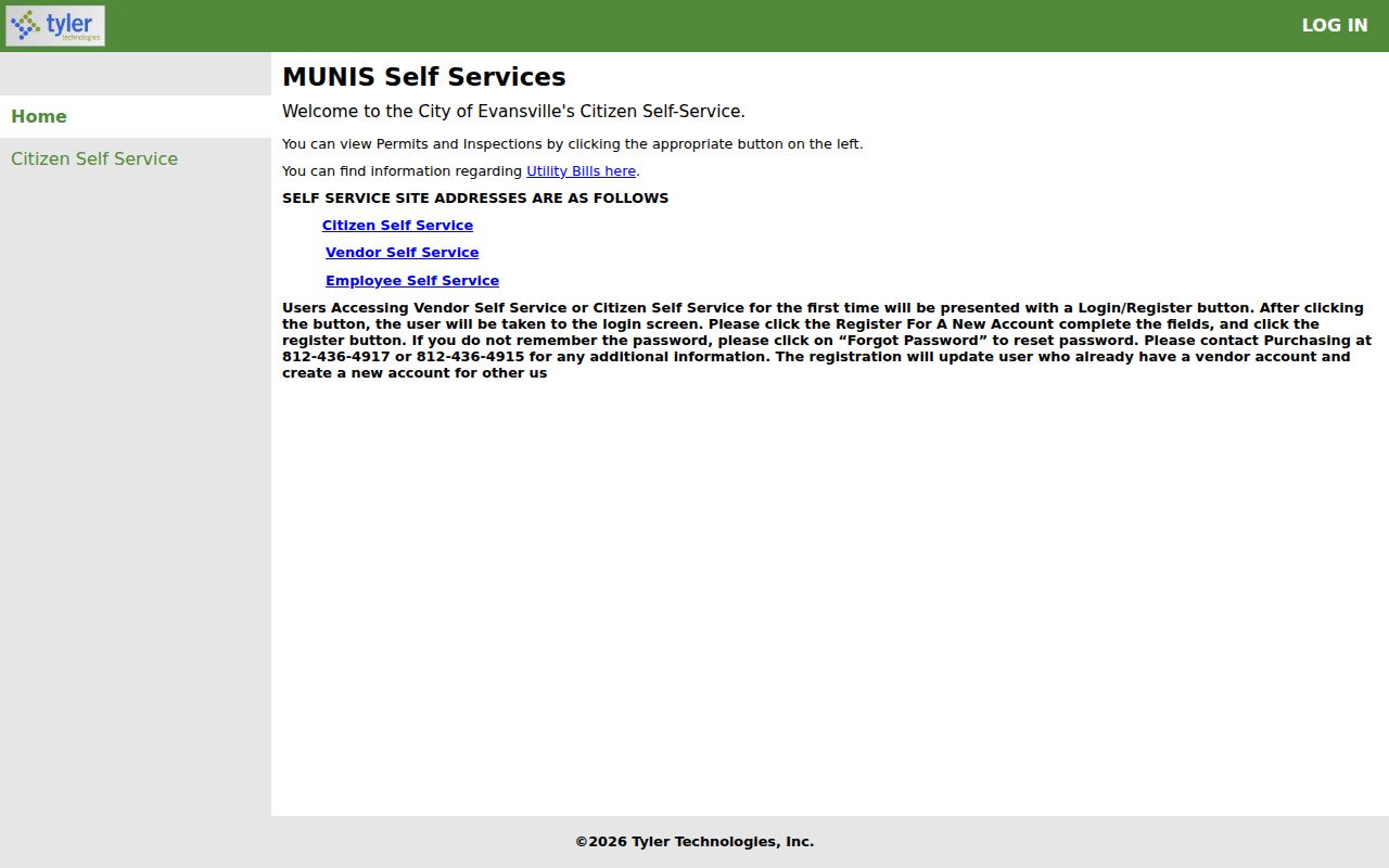
If an older event is absent, send the Building Commission or Area Plan Commission a date-bounded request naming the address, parcel, and record type. A Sanborn-map change can help define the likely date range.
Check Evansville Street Tax Rows
The Vanderburgh Treasurer search accepts district number, parcel number, name, tax year, and property address. Results are paged, and the portal warns that split or combined parcels from the prior two years may be easier to locate by last name. It also labels its display as not for official use.
The XSoft property result grid gives a cleaner row-by-row street view before a Treasurer comparison.
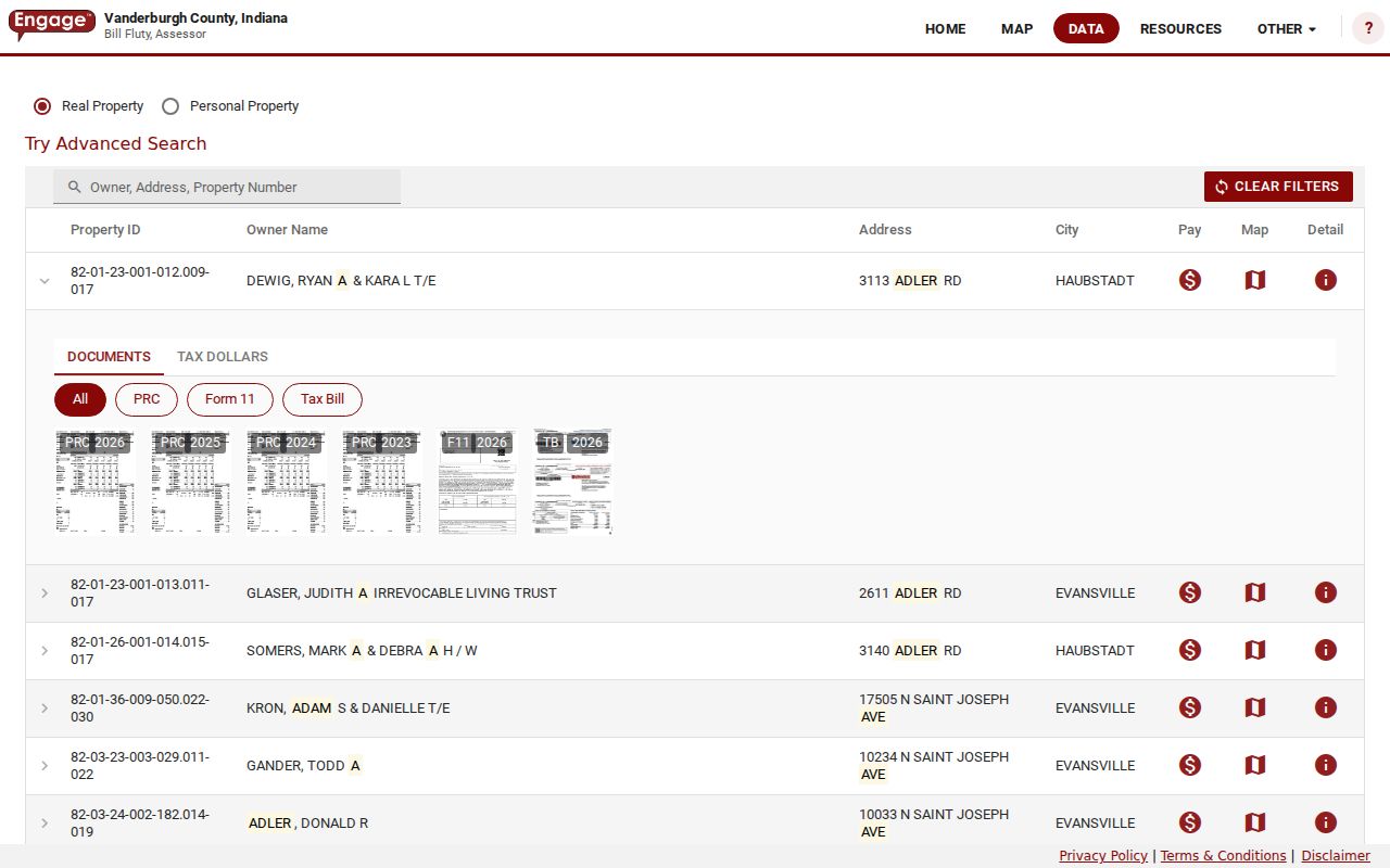
Save property IDs and addresses from the grid, then compare the same parcels in the tax roll. A tax row confirms a tax-system entry, not who occupies the site.
Evansville Street Numbers Changed
Evansville adopted numbering in 1873, and the 1874 city directory was the first local volume to use street addresses. Detailed street sections appeared by 1897. By 1903, the directories added intersections and railroad crossings. The 1929 volume provides the key old-number and new-number bridge.
Keep three fields for any old address: the directory number, the 1929 conversion, and the current parcel legal description. Willard Library's Streets and Buildings files, Sanborn maps, and Recorder plats can test whether the lot stayed the same after the number changed.
That 1929 bridge is a distinctive strength of the Evansville street directory trail. It prevents a false dead end caused only by renumbering.
Evansville Voter Street Limits
Indiana Voters is designed to check one registration through a name, date of birth, and required county selection. It is not a public download of all people on an Evansville street. Computerized file access runs through the VRG-24 process, with county approval, specified uses, and protected fields.
Use the public portal to verify a known person, not to infer a complete household. Names may fail when initials or suffixes differ from the registration. The Vanderburgh Election Office can address a no-match or correction question.
Note: A voter record and a parcel owner record measure different facts, so agreement is useful evidence but disagreement is not proof of error.
Evansville Streets in Old Directories
Later Evansville city directories can be read from an address toward a person. Start in a year-specific street section, note every printed occupant or business at the number, then move to the alphabetical section for occupation, spouse, widow, or business details where printed. Do not assume a separate criss-cross title exists beyond the documented street sections.
EVPL's digitized run begins in 1858, while Willard Library adds annotated building and street files. The full collection methods belong on the Evansville city directory page; here, each volume serves as one dated street snapshot.
Limits of Evansville Street Records
A public parcel roll does not list every person at an address. The owner may receive mail elsewhere, and a parcel may contain more than one unit. Utility customer lists are not public, motor-vehicle address data is closed under federal law, and protected voters or covered property owners may have restricted address information.
The best Evansville street directory result states what each source actually shows: a listed owner, parcel boundary, recorded party, dated permit, voter status for a known person, or historical directory entry. It does not turn those separate facts into an unsupported claim about a household.
Lawful use. Use Evansville address records only for lawful personal research, civic review, family history, or property questions. Never use them to stalk, harass, intimidate, or harm anyone.